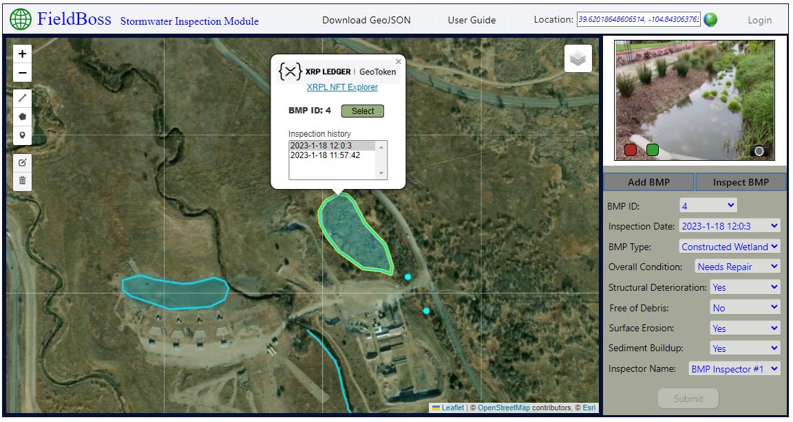
This week on Developer Reflections, we’re proud to highlight FieldBoss, a mapping application that merges blockchain technology with popular open source Geographic Information Systems (GIS) mapping tools through the use of geo-located XRP Ledger NFTs.
With FieldBoss, GIS applications are extended to include the real-time tokenization of 2D/3D unique geometries collected by field crews. By combining the analytical power of GIS (assets represented spatially) with the transparency, immutability, and security of blockchain technology, the team believes it can show the spatial and temporal distribution of information which is securely stored on the blockchain and distributed file systems.
FieldBoss is built utilizing xrpl.js, Leaflet, Ceramic and Node.js. The app is available on the XRP Ledger testnet and is currently configured as a sandbox demo that can be used to collect real data.

The team has already begun to receive positive feedback from environmental consultants regarding the potential use of FieldBoss for their field inspections. The XLS-20 protocol makes it easy for the FieldBoss team to mint and manage NFTs on the XRP Ledger, and enables the real-time tokenization of spatial geometries quickly and seamlessly.
Check out the Github repo to learn more.
Want to be featured in the Developer Reflections series? Submit your project today, and join the developer Discord channel to connect with other members of the XRP Ledger community.